blah blah blah
Fletcher Cascades
Length: 3.2 miles out-and-backDifficulty (click for info): Easy
Elevation Gain: 820 feet (+20 feet on return)
Rating (click for info): 6/10
River: North Fork of Drakes Brook
Driving Directions:
Trailhead and parking area are on Rt. 49, in Waterville Valley, NH, 9.8 miles from exit 28 off I-93. The parking area is up an incline off the east side of the road, and is signed for Sandwich Mountain Trail and Drakes Brook Trail. You will drive in the entrance and turn right into the main lot. Click here for a Google map.
About the Hike:
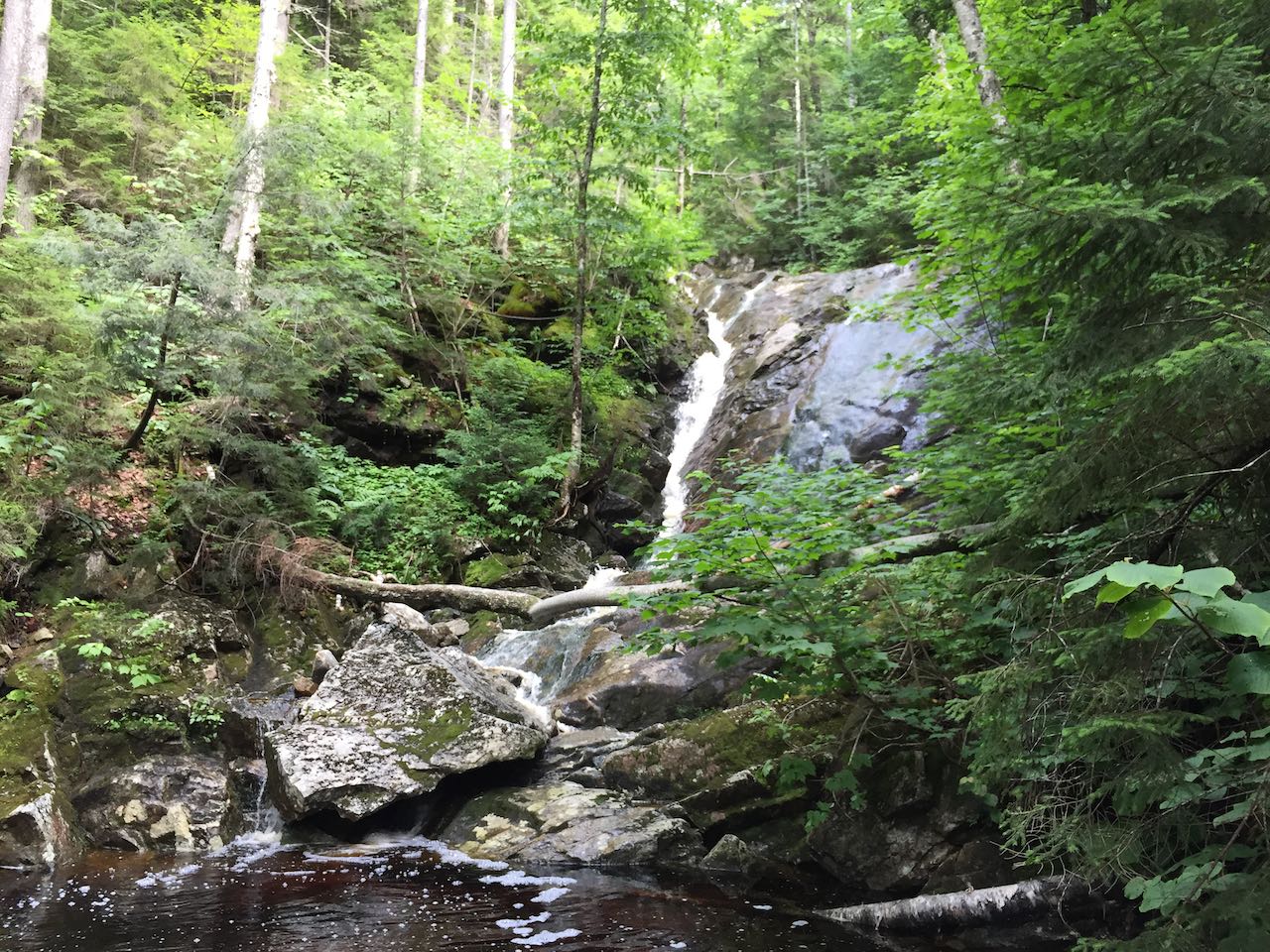
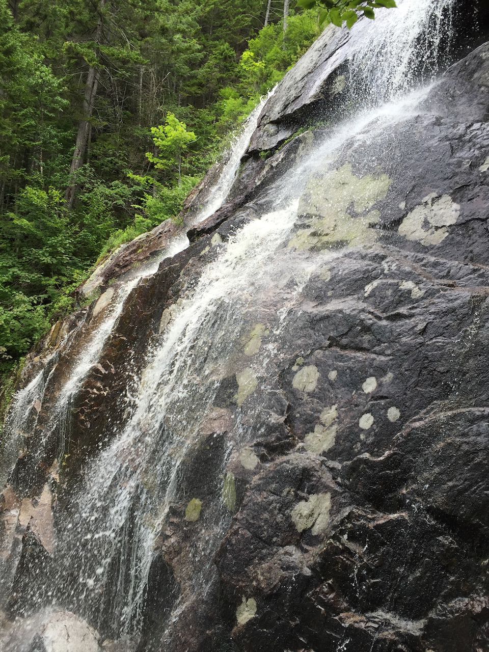
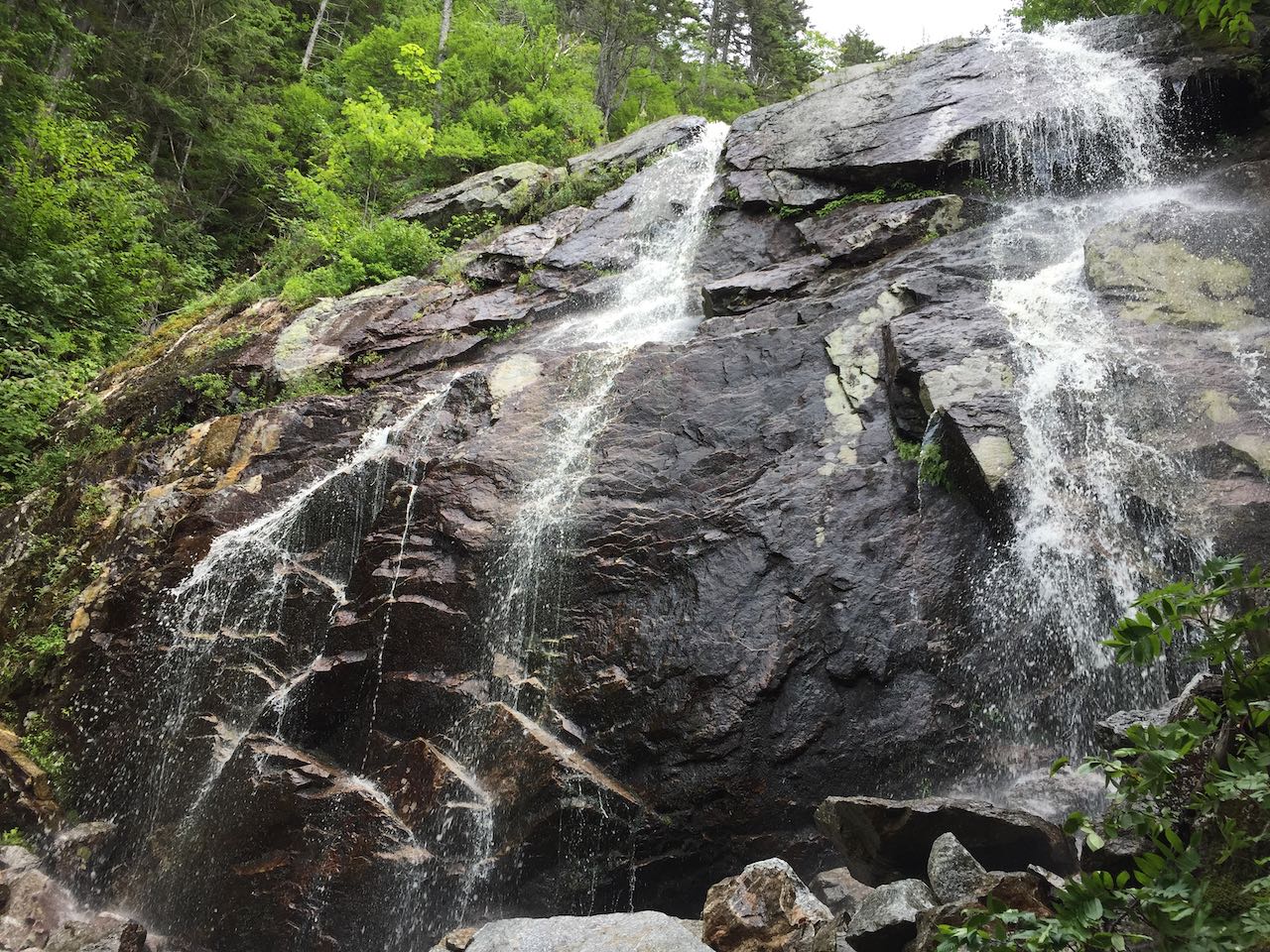
Fletcher Cascades is not a name often included in listings of must-see White Mountains waterfalls, which is unfortunate to the notoriety of its name but a benefit to preserve it to hikers who know where to look for the out-of-the-way delights. Fletcher certainly falls into that category, and little is written about its kinetic heights. You must traverse a lengthy side trail off the more popular Drakes Brook Trail coming off Jennings Peak to reach the series of waterfalls on the north fork of Drakes Brook, which drains off the northwest slopes of Flat Mountain. There are multiple attractive features on the brook to see, but the hike culminates with an awesome cataract where the brook careens over an imposing vertical cliff of uncertain, but respectable, height. When you first experience it, you will wonder why it is not spoken more frequently of.
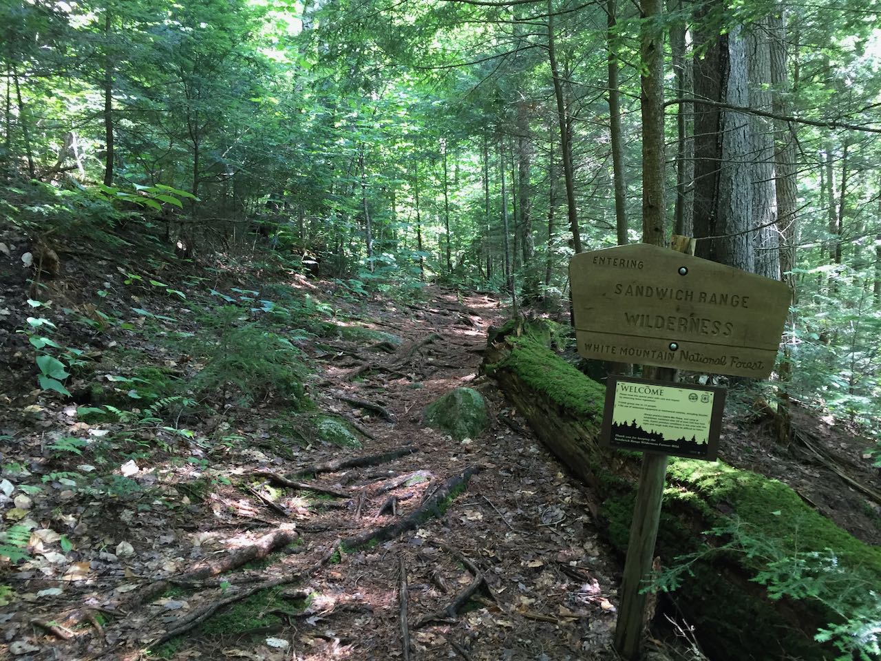
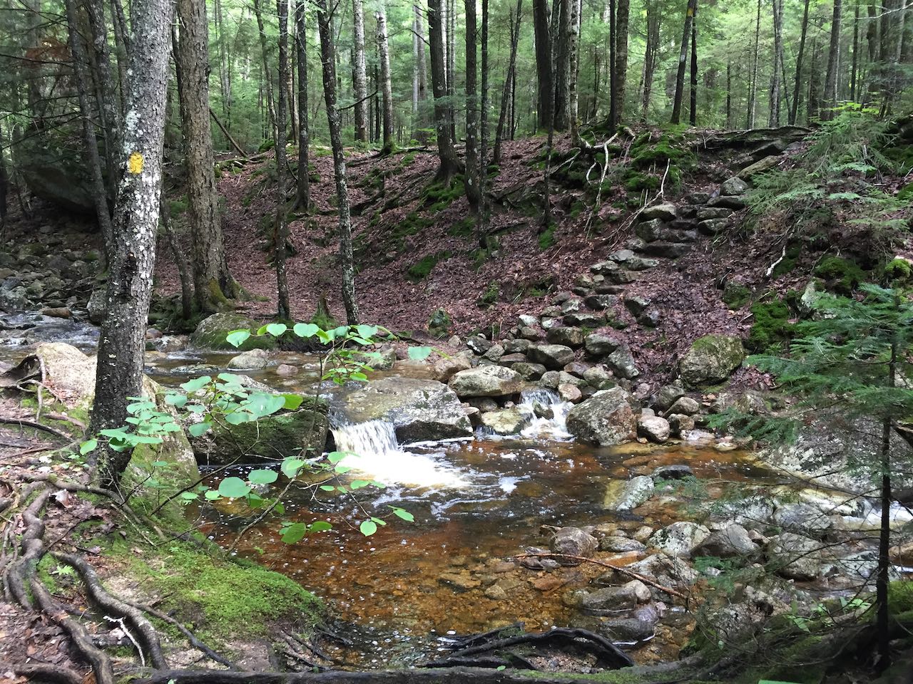
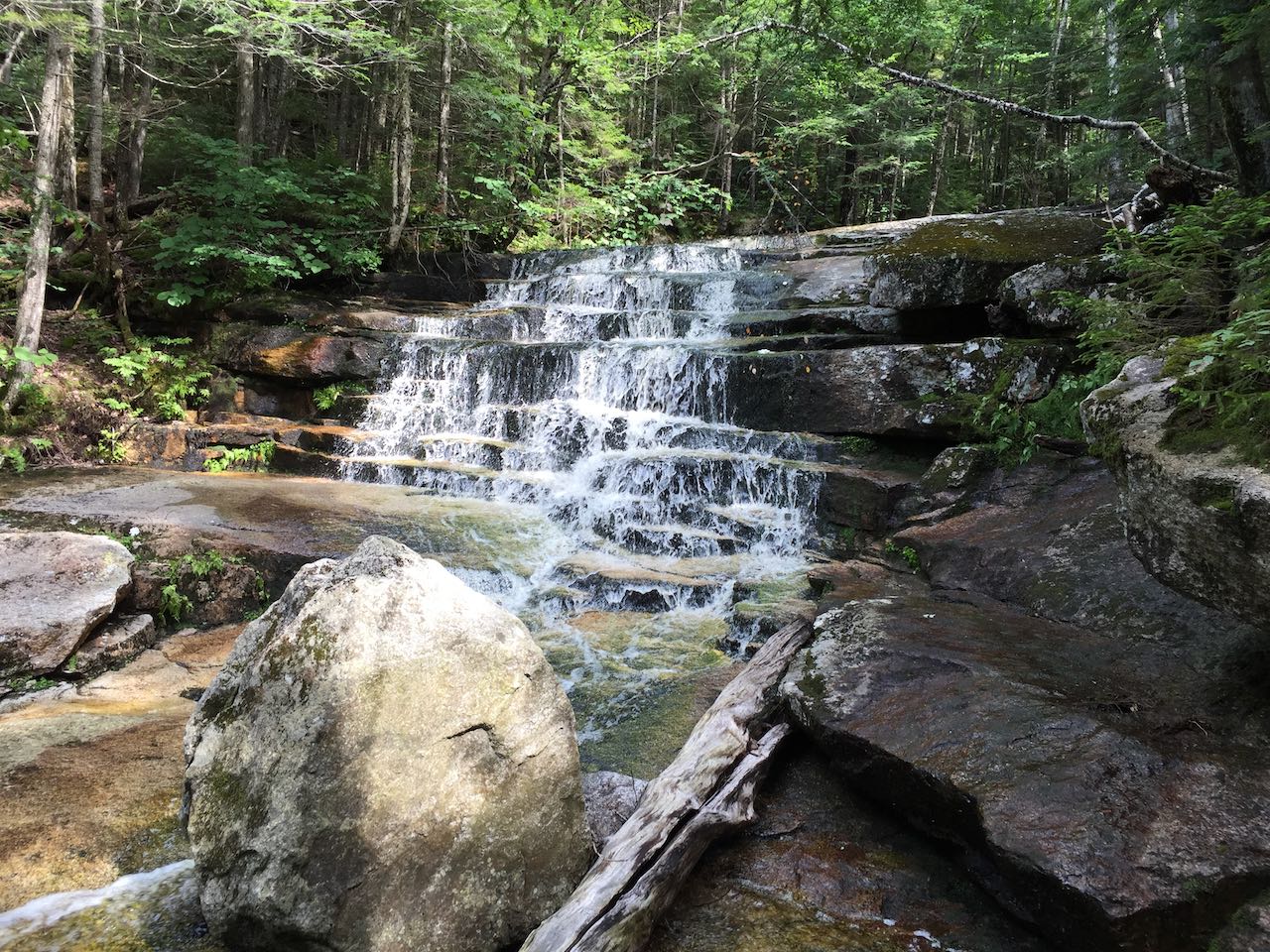
Start your trek from the left side of the parking area and follow the beginning of the Drakes Brook Trail on a wide multi-use path. The path swings to the right around the end of a clearing, and gradually approaches the bank of Drakes Brook, passing by bubbling rapids and chutes. After 0.4 miles, stay straight onto Fletcher Cascades Trail as Drakes Brook Trail takes a right to cross the brook. In 250 feet, bear right off the wide path onto a simple footway through the woods. 0.15 miles in, it crosses the boundary into the Sandwich Range Wilderness. The trail continues parallel to the brook at a distance, generally on the uphill, but with intermittent descents and levels. After 0.65 miles, the trail crosses the north fork of Drakes Brook on stepping stones and climbs a stone staircase up the opposite bank. This crossing may be difficult if the water is rushing. The trail continues more directly uphill near the brook now, pushing through encroaching hobblebush branches beneath a tall tree canopy. After a quarter mile, the trail approaches the first of the lower cascades, where the brook slides over a nice stepped ledge block and fans out over a long sloping expanse of bedrock. The trail now follows the brook closely as it becomes increasingly ledgy and boulder-filled. Up beyond some more minor cascades, one notable fall crashes down a high-angle gully in the rock and ends in a foamy pool. Past here, the trail climbs up the steepest inclines of the hike as it swings away from the brook in order to approach the midpoint of the highest falls. It turns left, crossing beneath a side cascade from brook runoff. Step out along a terrace in the middle of the sharp slope, emerging on a shelf in between the upper and lower drops of the waterfall. Below you, the brook runs off down lower-angle cascades, while the cliff looms above you. In drier conditions, the brook splits into two streams as it flows over the main drop.
Printable directions page